Saturday, August 27, 2011
Before Hurricane Irene Hit Brooklyn Heights
In spite of buying about a hundred dollars worth of survival food and water yesterday, we were looking for something good. Gristedes was pretty much sold out.
Key Food on Montague Street was closed.
Even Starbucks was closed!
But there, like a lovely oasis, was Lassen & Hennigs. Neighborhood folks were shopping like there wasn't going to be a hurricane in a couple of hours and they had plenty of everything that all the other stores were out of: cases of water, salads, pastas, dinner stuff, sandwiches, snacks, but best of all . . .
Hot, juicy, mouth-watering, fresh-roasted chicken! Way to go, Lassen! We're coming here before every hurricane.
Photos by MK Metz
Go to McBrooklyn's HOME PAGE.
Irene On Way, and Now a Tornado Watch in Brooklyn and All New York City
![]() |
| Waiting for Irene on Brooklyn Heights Promenade. |
Probably time to stay inside.
- Storm Surge Will Hit Brooklyn
- Hurricane Irene Prompts Hazardous Weather Outlook In Brooklyn, New York City
Photo by MK Metz
Go to McBrooklyn's HOME PAGE.
Hurricane Irene: Storm Surge Will Hit Brooklyn - UPDATED Saturday p.m.
FEMA warns that the greatest potential for loss of life related to a hurricane is from the storm surge.
Storm surge is water that is pushed toward the shore by the force of a strong storm or hurricane, such as the rapidly-approaching Hurricane Irene. This advancing surge combines with the normal tides to flood roads, homes and critical infrastructure.
Compare the National Hurricane Center's storm surge probability map above, calculated Saturday at 4 p.m., with the one below, calculated Thursday.
The areas that are now in the purple zone -- Bay Ridge, Fort Hamilton, Bath Beach, Coney Island, parts of Red Hook and Gowanus, (lower) Brooklyn Heights, DUMBO, Vinegar Hill, the Navy Yard, Williamsburg, Greenpoint, Brighton Beach -- have a 100 percent probability of getting at least two feet of storm surge. They have a 40 -50 percent chance of four feet of storm surge. This is double the amount of storm surge calculated Thursday.
The reddish-purple areas -- Brighton Beach, Manhattan Beach, Marine Park, Gerritsen Beach and most of the Rockaways -- have an 80 - 90 percent probability of at least two feet of storm surge.They have a 30 -50 percent probability of at least four feet of storm surge.
The small green areas near Gowanus and part of Red Hook have a 10 - 30 percent chance of at least two feet of storm surge.
Storm Surge Probabilities Calculated Thursday, August 25
The map above shows the storm surge probabilities for the area as calculated at 5 p.m. Thursday evening.
Check with NOAA's storm surge calculator as the Hurricane Irene approaches to see if your neighborhood is in danger from storm surge.
Hurricane Irene Prompts Hazardous Weather Outlook in Brooklyn, New York City
Go to McBrooklyn's HOME PAGE.
Hurricane Irene In Brooklyn -- Hunker Down Saturday
![]() |
| Hurricane Irene 8-27-11 noon NOAA |
Brooklyn, Long Island and all of New York City is under a hurricane warning. The full Category 1 storm is expected to hit us tonight with winds between 55 and 80 miles an hour in Brooklyn, with higher gusts in Long Island. The greatest danger to us here is from the storm surge.
Stores Closing Early -- Last Chance to Get Supplies
Reports are in that some stores are closing early to let employees get home. It's not or never, folks!
Things You Need to Buy Before the Hurricane Hits
A full-system shutdown is underway.
The subways and buses are now closed or closing, as are the LIRR and Amtrak. Some PATH trains will remaining running til 6 p.m. today (Saturday).
Mayor Bloomberg has issued a mandatory evacuation order for the more than 370,000 New Yorkers residing in the low-lying areas called Zone A areas, and in the rest of the Rockaways, which is classified as Zone B. (Zone B is higher, but the Rockaways are a special case because if the bridges get closed, there's no way off the island.)
Here's a zone finder to see if you live in an evacuation zone.
Here's the city's evacuation map (pdf).
Map Problems: The city's evacuation map is crashing. Try the New York Times.
Staten Island Ferry service will be suspended as of 10 p.m. tonight or earlier if the winds come earlier. Mayor Bloomberg said this morning that city bridges may close if high winds make driving across them dangerous. The TBTA and Port Authority bridges, which tend to be the bigger, higher bridges, may close even earlier.
If the low-lying areas begin to flood, Con Ed may have to shut down their power lines. NYCHA buildings will be shutting down their elevators, as will other buildings. If winds reach 100 mph the Indian Point nuclear plant may shut down, reducing the city's available electricity.
Evacuation Center Note:
The Evacuation Center at JHS 57, 125 Stuyvesant Avenue, Brooklyn, is being closed. The center will be moved to PS26, 1010 Lafayette Avenue, Brooklyn.
Yankees and Mets games have been canceled. Giants and Jets games have been moved to Monday night.
More:
- Hurricane Irene Prompts Hazardous Weather Outlook In Brooklyn, New York City
- Hurricane Irene: Storm Surge Probabilities Increasing for Brooklyn
Go to McBrooklyn's HOME PAGE.
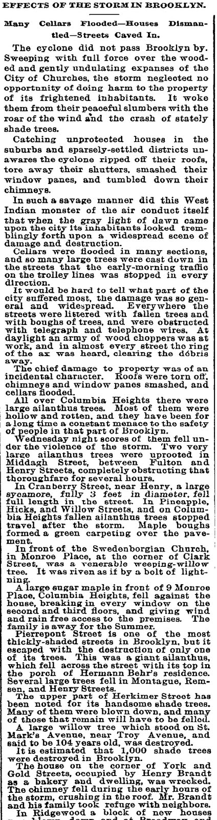
The Old Days: 1893 Hurricane in Brooklyn Heights and Downtown Brooklyn
Here's the beginning of an article published in the New York Times in 1893 which gives a fascinating look at the damage caused in Brooklyn Heights, Downtown Brooklyn and the "sparsely settled suburbs" from a monstrous hurricane (called a cyclone by the paper) that swept through the independent city of Brooklyn.
The subhead reads: "Many Cellars Flooded -- Houses Dismantled -- Streets Caved In"
According to Wikipedia, winds from the storm exceeded 50 mph. At Coney Island, the storm completely destroyed many buildings, walkways, piers, and beach resorts. Brighton Beach was also hit hard. Houses were dismantled and uprooted trees blocked streets.
Click to enlarge.
Read the rest of the article here.
Go to McBrooklyn's HOME PAGE.
at 12:58 AM Labels: Brooklyn, Brooklyn Heights, Downtown Brooklyn, history, macrobrooklyn, real history, weather
Friday, August 26, 2011
Hurricane Irene from Space, Friday at Noon
Hurricane Irene updates here.
Credit: NASA Goddard MODIS Rapid Response Team
Go to McBrooklyn's HOME PAGE.
Tacky Changes To Gage & Tollner in Brooklyn Made Without Landmarks Approval
Landmarks says the hot pink material and wall panels installed by the new tenant of the landmarked former Gage & Tollner restaurant on Fulton Mall may have to go, reports the Brooklyn Eagle.
Amazing it got away with this for so long.
Go to McBrooklyn's HOME PAGE.
Things You Need To Buy Before the Hurricane Hits Brooklyn / New York City
(Note: This is NOT a "Go Bag." This is a stay at home shopping list. If you are in an evacuation zone, you had better get your Go Bag ready now.)
- Cash: Get enough cash for a few days' needs. Break it into smaller denominations. (Remember the last time the power went out none of the ATMs worked?)
- Basics electronics: Flashlight, transistor radio, batteries. Here in Brooklyn, many drug stores and major groceries have already sold out of several sizes of batteries -- go to little bodegas and oddball stores to find them.
-
- Water: Fill up jugs with water, or buy a 24-pack of Poland Springs drinking-size bottled water -- $4.99 at CVS, $9.99 at Gristedes. Get some individual juices if you like them. (Fill up your bathtub for water to flush the toilet. You'll need a bucket or plastic garbage can for this.)
- Food*: Granola and protein bars, nuts, a box of crackers, cans of tuna fish or other protein (after your mayo goes bad pour in a little oil), fresh peaches and apples, dried fruit, single serving canned fruit. Want hot food? Buy a couple of cans of Sterno (you'll need matches!) and some canned food or dry packaged meals and soup. If you like cereal make sure to buy powered or canned milk or Parmalat. Get some cookies and snacks. Buy paper plates, cups and utensils (there may be no water to wash dishes). Make sure you have a manual can opener.
*(You're going to eat this stuff after you have first eaten the food in your refrigerator that will spoil within a few hours. To keep items cooler longer, avoid opening the fridge unless absolutely necessary.)
- Pet food! Kitty litter!
- Important Meds: Aspirin, prescriptions and anti-diarrhea medicine. Hand sanitizer. Rubbing alcohol. Contact lens solution. Toilet paper, paper towels, tissues. Feminine supplies. Condoms. Baby wipes to wash up if the water stops.
- Baby Things: Diapers, baby meds and formula, baby food. (Again, baby wipes to keep them clean if no water is available for baths.)
- Communications: Charge your cell phone and other electronic gear. If circuits are busy send text messages, which will go through if any cell towers are working, even if voice doesn't. If the power is out altogether, standard landline phones, which run on the power running through the phone wires, usually work.
- Misc.: A book to read. An itty-bitty book light.
NOTE: Electric stoves won't work in a power failure. Gas stoves with a pilot light work even if the electricity goes out, but the newer gas stoves have an electric igniter and they won't work. You may be able to manually light them with a match, however.
Ready.gov has much more information about preparing for a hurricane emergency.
More Here:
- Hurricane Irene Prompts Hazardous Weather Outlook In Brooklyn, New York City
- Hurricane Irene: Storm Surge Probabilities Increasing for Brooklyn
Photo by Jeff Keen, Creative Commons license
Go to McBrooklyn's HOME PAGE.
at 6:30 AM Labels: Brooklyn, macrobrooklyn, natural disasters, New York City, USA, weather
Hurricane Irene Prompts Hazardous Weather Outlook In Brooklyn, New York City- UPDATE
UPDATED: Saturday, August 27 here
UPDATED: Friday, August 26:
According to NOAA as of Friday morning:
IMPACTS FROM HURRICANE IRENE ARE LIKELY FROM SATURDAY NIGHT INTO SUNDAY NIGHT. CONDITIONS ARE THEN LIKELY TO RAPIDLY DETERIORATE IN TORRENTIAL RAIN AND STRENGTHENING WINDS LATE SATURDAY NIGHT.
THE WORST CONDITIONS ARE LIKELY LATE SATURDAY NIGHT INTO SUNDAY AFTERNOON WITH INCREASING POTENTIAL FOR DAMAGING WINDS...FLOODING RAINS...AND SIGNIFICANT COASTAL FLOODING ACROSS MUCH OF THE REGION.
DEPENDING ON THE TRACK...INTENSITY AND TIMING OF THE HURRICANE...A DANGEROUS AND POSSIBLY LIFE THREATENING STORM SURGE COULD OCCUR LATE SUNDAY AFTERNOON INTO SUNDAY EVENING.
ADDITIONAL IMPACTS FROM THIS SYSTEM COULD BE SIGNIFICANT BEACH EROSION...WHICH COULD BEGIN AS EARLY AS FRIDAY NIGHT AS LARGE SWELLS FROM IRENE BEGIN TO ARRIVE.
SIGNIFICANT AND WIDESPREAD URBAN AND POOR DRAINAGE FLOODING WILL ALSO BE AN ISSUE. AS A RESULT A FLOOD WATCH IS IN EFFECT FOR THE AREA.
NOW IS THE TIME TO REVIEW YOUR HURRICANE PLAN.
BE READY TO EVACUATE IF NECESSARY.
Storm Surge Updates Here
Things You Need to Buy Before the Hurricane Hits
* * *
Tuesday, August 23
Irene is presently a Category 2 hurricane near the Bahamas, but is expected to increase to Category 3 shortly. While the timing is uncertain this far in advance, the impacts of the storm could begin hitting this area on Saturday, according to NOAA.
From NOAA:
IMPACTS FROM TROPICAL SYSTEM IRENE ARE POSSIBLE LATE THIS WEEKEND AND FOR THE START OF NEXT WEEK. THE TIMING IS UNCERTAIN...BUT IMPACTS COULD BEGIN STARTING ON SATURDAY. HEAVY RAIN AND STRONG WINDS ARE POSSIBLE DURING THIS TIME PERIOD.
ADDITIONAL IMPACTS FROM THIS SYSTEM COULD BE SIGNIFICANT BEACH EROSION...HIGH SURF WITH DANGEROUS RIP CURRENTS...AND COASTAL FLOODING.
The Christian Science Monitor reports that Irene "could reach Category 3 as early as Tuesday and possibly become a monster Category 4 storm within 72 hours."
Go to McBrooklyn's HOME PAGE.
Thursday, August 25, 2011
Another Pedestrian Mowed Down By Biker On Brooklyn Bridge
Another in a long list of near-death experiences, a biker ran into a pedestrian on the bridge walkway at roughly 6 p.m. yesterday. Witnesses said that the pedestrian was in the pedestrian half of the walkway, and the biker ran into her from behind.
The biker stopped momentarily, witnesses said, but was not present as emergency responders from FDNY stabilized the victim's head and neck and carried her to a waiting ambulance.
Biker / pedestrian collisions are a frequent occurrence (here, here, here, here) on the Brooklyn Bridge, packed with thousands of pedestrians and fast-moving bikers during rush hours. Pedestrians are supposed to stay in their half of the walkway and bikers in theirs, but the narrow lanes are so crowded that this is virtually impossible.
Bikers fear oblivious tourists and darting children, and pedestrians are terrorized by a minority of bikers who blast past them, just inches away, at 30 mph.
This is an ongoing problem. Some possible solutions are here.
UPDATE: The Brooklyn Eagle has more details on the collision here.
Photo by MK Metz
Go to McBrooklyn's HOME PAGE.